


Before GPS made some people consider paper maps antiquated, one of the means to figure out where you were and how to get to where you wanted to go was paper maps.
With this posting are parts of three paper maps.
Map 1: One map (in color) has a 99W sign rimmed in black on the lower left hand side. On the right lower side is “Sue Buel Elementary School (Opens 9/08).”
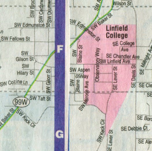
Map 2: Another map (also in color) had a purple line with the letters “F” and “F” cutting vertically through the center of the map.
Map 3: The third map is in black & white.
= On Map 1 notice “Taft Street” in a neighborhood adjoining Linfield. It’s a horizontal line. One of the intersecting streets is “Blaine Street.” Another street, this on the Linfield campus is represented by a vertical line. It’s Renshaw Avenue. A story "For whom is McMinnville’s Blaine Street named?" looks at the naming of Blaine Street and Taft Street. Link to the story: https://mac97128news.blogspot.com/2019/01/for-whom-is-mcminnvilles-blaine-street.html?m=0
= On Map 2, on the far left side, note “SW Cozine Lane.” There is a “Cozine Way” on the Linfield campus. It’s on Linfield maps, but the cropped Linfield map (Map 3) shown here cropped out that Cozine. Now, remembering where Renshaw Avenue is located from Map 1, look for it in Map 2. It’s there, but it’s called “Observatory Way.”
= Map 3 is the easiest to see/read map of the three here. That’s enough reason to include it here.
#


